Can Tin Bounding Still be done Today?
Free Mining in Cornwall is the earliest of anywhere in the British Isles. So, in the 21st century, what remains of the Cornish Tin industry’s earliest medieval administration?
Plantagenets to the Victorians, the Cornish have been winning tin metal from the very earth beneath our feet. So, is the current cessation of mining merely a hiatus or a final valediction? One thing’s for certain; mining has changed forever, but will Cornwall’s unique, 800yr old custom of Tin Bounding survive into the 21st century?
Well, it’s a definite maybe. Here are my thoughts...
Tin Bounding was the earliest recorded form of administrative control over tin mining in Cornwall.
The 3rd John, A.D. 1201 charter, in a feat of classic Plantagenet sequestration, details customary rights of the 12th century Cornish tinner:
"... [To] all our tinners in Cornwall and Devon, that they may at all times freely and quietly, without the disturbance of any man, dig tin, and turves to melt their tin, anywhere in the moors, and in the fees of bishops, abbots, earls, as they have used and been accustomed..."
What one must take away from this is that by engaging with mining you underwent a metamorphosis of class and were subject to an entirely independent jurisdiction. This is comparable to the military courts martial today, with its own feudal spin. Although no mention of bounding is made in the charter, the "freedom to work" can be interpreted in a manorial context to mean "freedom to exercise right of exploitation of tin on manorial land without bespoke royal charter".
Bounding was a well-established practice by the end of the 15th century. Under the privileges granted through the charter of John and successive iterations, corners would be pitched as stones or mounds of earth and then "... behoveth him [the tinner] straight way at the next court holden within the stanary where his worke is, to enter his said work upon the court bookes to the entent there it may be proclaymed..." (that isn't the forerunners of dyslexia, its Elizabethan vernacular, before spell check!).
One such of these stannary court books has survived through the collection of a Devon solicitor for the years c1498-1503, and can be viewed in the British Library as additional MS.
To continue this explanation, one must entertain a tangent about Manorial tenure...
Cornwall first became a kingdom in the 9th century following the Battle of Hingston Down (beforehand, the place we now call Cornwall was part of the Kingdom of Dunmonia) and soon after this the first still-existing divisions of the land were made. These were the Hundreds and are potentially the earliest unaltered vernacular that still survives as place names today.
Next likely came the manors by direct gift of the king. Prior to the statute of Quia Emptores, some 300 manors were recorded in the Domesday survey of 1086, and many held their origins in Anglo-Saxon times. The great book makes a habit about recording who owned certain manors before the invasion and who the alienator's successor was; the pedigree of these 'fees' were obviously respected by the Norman invaders even back in the 11th century.
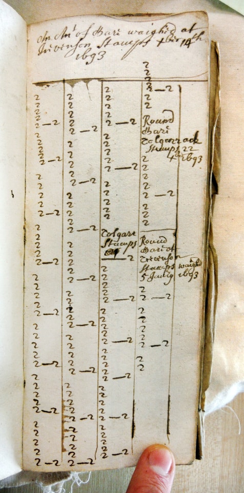
With them, the Normans brought many of the modern manorial tenures. The "manorial" itself (the extent in size of the manor: the fee) and the "title" (the ownership - lordship - of the manor) are thought to potentially have Roman origins, but thanks to the French occupation a third aspect of Lordship was crystallised.
The Seignory or Manorial Rights were, and to some extent still are, privileges endowed to the title of the manor. Examples of this might be right to wreck or right to deodand (both of which were successfully revived in the 19th century by the Bassets, but the Peelite Government naturally took lofty objection and passed acts to limit these powers).
The most important of these Manorial Rights for this explanation however is the right to mining & minerals. Throughout the post-1066 medieval period (5th-15th centuries) "mineral rights" were primitive tenure, affording little entitlement besides that relating to metal/ore itself. There is no reason to believe their 'volume' was considered fee, or even normative chattel.
The King John Charter of 1201 is pivotal about the right to work on the lands of others, under manorial jurisdiction, without the hindrance of overlords. It is thought that at this time tin mining was yet to venture underground (in any practical capacity), and hence the question of "property" over mines were indistinguishable from ownership of the soil. Royalties on mining produce were to be paid to the "Lord of the Soil"; even if the interest in minerals were conveyed the freehold remained under the original manorial title. Hold this thought...
Bounding was a liability-free operation for the villein Tinner. Only the names of the working persons and location were recorded in stannary court bounds registration. The instantiation of the stannaries to regulate tin mining annexed and superseded the manorial jurisdiction to that date exacted by manorial courts. The state of the tin industry towards the end of the medieval period was still not geared towards effective exploitation but was benefiting from intelligent administration.
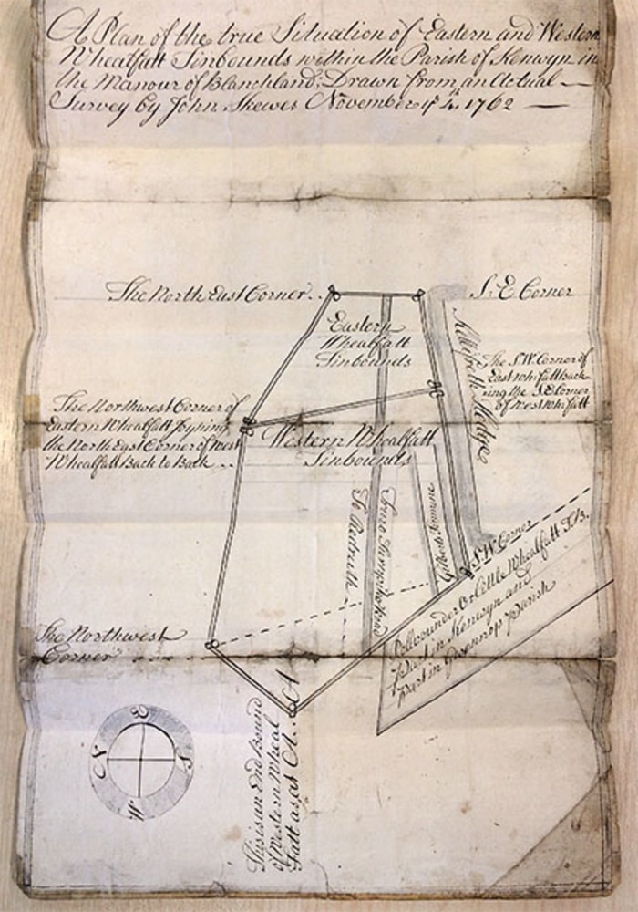
Cornwall's potential began to be recognised in sympathy with the expansion of the English navy and ancillary demand for bronze making. Up until the late Tutor period the only manorial fingers in the mining pie were the collection of royalties from mining profits; this was known as "Toll Tin" - the portion payable to the Lord. It is this that the seignory interest in minerals amounted to: you often see right to "Toll Tin" exchanged between parties in the late middle ages (1200-1480).
Exploitation of the 'shoad' - the alluvial/eluvial tin deposits - was typically conducted on unenclosed wastrel land of the manor. Under the feudal system, the categorisation of land was immensely important; wastrel (waste) carried no value if not for mining, and hence the only vested interest in minerals were the royalties that could be paid on their working.
With newly developing technology – particularly underground mining - effective working of mineral reserves required "setting" out conditions and method besides mere situation. In order to accommodate these diversifying means and methods, more fleshed-out legal agreements were entered. The earliest surviving example of these Mining Setts, though likely not the first, relates to tinworkings near Porkellis:
"... Betwene Henry Donston of Mowgan in Menedge in the countie of Cornewall yeoman of thone partie And John Thomas of Costyntine in the said Countie gentleman of thother partie Witnessethe that it is covenanted bargayned graunted & agreed betwene the said parties in Manner and forme following ffirst the said henry for hym and his heires dothe licens Bargayne and graunt to and withe the said John Thomas his executors and assignes that hit shalbe lawfull to the said John Thomas to Sett and let all the Severall Partes porcions and rights in Porthkillis of the said Henry Donston John Oppy Wylliam (sic) Trethowyn [Trethowan] Wydow in the parishe of Gwynderne"
In this agreement the lords of the soil were John Oppy and Wylliam Trethowyn's Widow; Henry Donston [Dunstan] is the bounder, and John Thomas is the 'farmer'. Dunstan held the tin bounds in the manorial of Oppy to which toll tin royalties were paid. These were registered with the stannary courts from which a portion of the toll tin was then made payable to the crown as lord paramount (1/10th). Dunstan "sett" the conditions for John Thomas to work within these bounds, in this case paying 1/6th royalties to him. This is "Farm Tin".
The agreement made between the parties was extrajudicial to the concern of stannary courts, but instead fell under administration of the manorial courts. Setting, or farming, was the lowest level of mining available to the Tinner in the early modern period (16th-18th cents). Bounding was the concern of the stannaries - an intermediate level, as this fell under the Bailiff and in turn the Lord Warden who was appointed by the Crown (Lord Paramount) itself. The highest level of mining was the concern of the Crown itself by royal charter; and remained a practice in certain Devon Lead mines such as Coombe Martin or Bere Alston into the early 17th century.
This should satisfy to explain the context of bounding as a tenure of mining, but its nature as property needs to also be discussed. The differentiation between bounding and setting was designed to appease the interests of the stannaries (eg: the crown) and manorial lords. Stannary law was in the most part set by act of Convocation (royal ramblings). That of the 30th Elizabeth (1563) intended to:
"pardon, remise, and release, Robert Willoughby, Lord de Brooke, John Mohun, Esq., John Godolphin, Esq., James Erisey, gent., and others, amounting, in the whole, to 1500 persons, with the several additions of knights, esquires, and gentlemen," otherwise called "tinners, bounders, or possessors of works of tin; and to the bounder, or possessor of any tin-work, in the county of Cornwall, who have not, or hath not, introduced the names of new possessors, or a new possessor, of any tin-work newly bounded, with the names of the works in the next Court of Stannary after the bounding aforesaid, showing the names or name of the possessors or possessor of the same works or work of tin, with the metes and bounds of the said works or work, as well in length as in breadth;"
… and for other offences against the Stannary laws, particularly enumerated:
"all transgressions, contempts, impeachments, forfeitures, concealments, fines, pains, imprisonments, amerciaments, debts and losses adjudged, or to be adjudged, abuses, retentions, and offences against the form of any statutes, ordinances, provisions, restrictions, or proclamations by us, or by our progenitors, before this time made"
This gives a sense of the power the courts had over the industry and those involved in it. This control served as an effective foot in the door to see tax end up in the crown's pocket; hence the insistence to register bounds, or else. This custom of the Stannaries could be said to be in turn, styled after manorial 'custom'. Indeed, setting was a practice carried out according to the custom of a given manor and recorded in manorial court books.
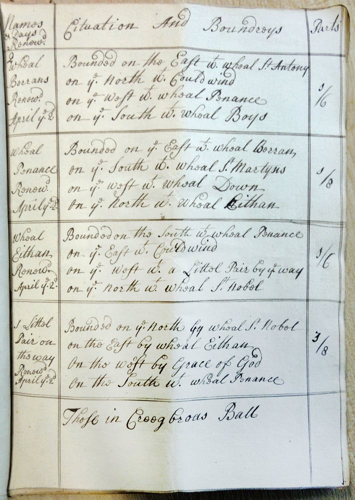
Under a further Convocation, 4th James 2nd (1687), bounds were declared by custom of the stannaries "a chattels real", meaning they could be sold as property, mortgaged and et cetera. What this meant is that enterprising bounder might not own title to land, but with intelligent investment a fortune could be returned. This is the antithesis of feudal hierarchy whereby the richest individuals owned the most land; typically this was prized if it were arable but with the rise of the mining industry wastrel, previously discarded as common land and deemed worthless, suddenly saw its value sky rocket.
Correctly located freeholds with the relevant rights saw the rise of capital driven economy and a rising merchant class. The likes of the Bolithos, the Vivians and the Borlases families likely hold their roots in this shift in industry from agriculture to mining. Indeed, a bounds book detailing Borlase's chattels (mainly tin bounds) exists for this decade, dating to 1655, in the archives in Redruth.
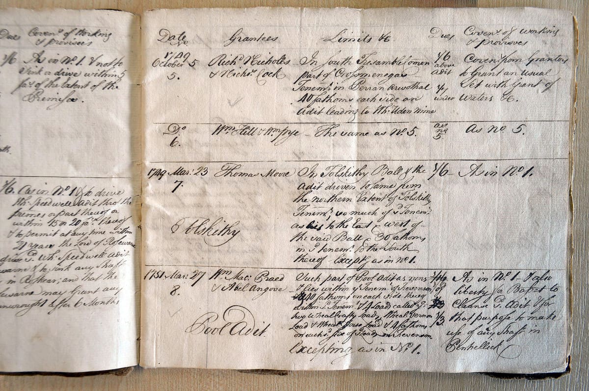
Bounds books were a tool for estate management introduced about the time of the James 2nd convocation as a means of tabulating one's ownerships into one folio, where previously they would've been entered into court books as prose. Many exist from the early 18th century and record exactly the same information as stannary court books of the 1400s do.
Sett books record much more fleshed out descriptions of the work undertaken at a given mine, as well as detailing situation. The enterprising new class of merchant land owners often bounded their own lands as investment for prospective miners, hence cutting out the middle man and simplifying royalties. The Bassets are the class example of this.
Mapping the Mining in Cornwall: Archival Plans of Tin Bounds
Cornwall was probably the last place in England to see an appreciation of cartography when recording property. Land surveying and valuation was typically recorded in schedule, detailing acreages, land use and name. Spatial detail was not relevant because one could trace this through word of mouth, in a time where feudal pedigree of lessees and etc., were often ancient and unbroken.
After topping Charlie 1st, fun-spoiler Oliver Cromwell initiated surveys of seized crown, episcopal and ecclesiastical lands; that of the Duchy of Cornwall has been republished by the Devon & Cornwall Records Society for 1650 and is worth a read.
Boundary disputes were common though, and it became clear that the most precise way of recording real estate was with mapping. The first real estate maps were produced by Joel Gascoyne during the 1690s. For the Robarts of Lanhydrock, there are 3 folios, leather bound & vellum, still residing in the house store (the family retained them as prize possessions after making their accession to the county archives), but recently the complete work has been published by Cornwall Editions Ltd. Even at £150, it is a bargain.
The segue that I make by exploring this tangent is that Gascoyne made a feature of recording tinworks but did not record bounds.
It is unclear which is the earliest surviving plan of tin bounds, but I think that it is a misconception that the infamous plan of Polgooth Mine dates from c1695 and therefore holds this title. It is important to mention the Lanhydrock atlas, as this has been dated accurately, and highlights the stylistic differences between it and the undated Polgooth plan of bounds. The dating has been produced by the archive’s staff, who give an explanation of their method in the item listing [AR/18/8]. This has then been republished a number of times, for example in Buckley's Story of Mining in Cornwall.
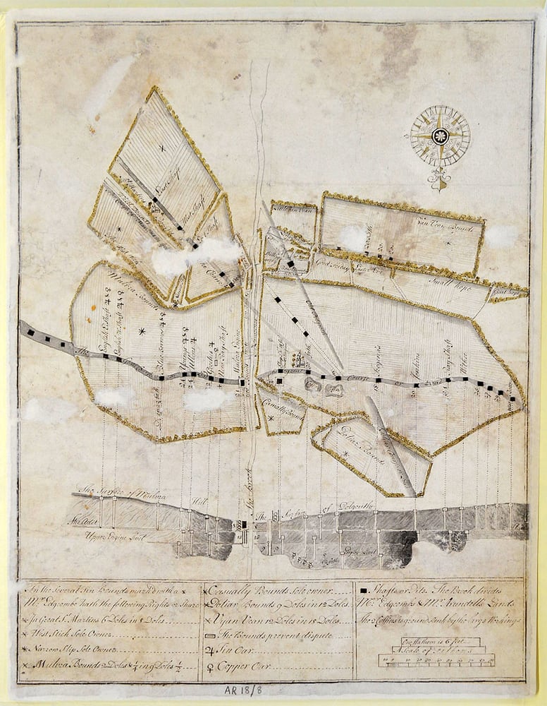
Stylistically there is no comparison with Gascoyne's works. Its medium - ink/watercolour on quality pressed paper - is simply not appropriate to be considered late 17th cent. All other cartography at this stage, likewise larger surveys and legal documents, were produced with the cheaper and more durable vellum. The hand, of unknown authorship, is about 50yrs ahead of its time if it is supposed to date from the end of the 17th cent - it would be like Winston Churchill wondering round with an iPhone.
With regard to style, medium and in character with the needs/customs of the time; I would date it to post 1750 at the earliest. It is identical in all of these merits to a 1762 plan of Wheal Fatt bounds in Kenwyn (one near the crossroads at Scorrier).
If I am correct in my assumptions made in lieu of any exhaustive study (by consulting court books, one will find mention of many lost bounds plans, or undated existing ones), this leaves the floor open to discuss what might truly be the earliest bounds plan.
William Doige was the cartographic surveyor of choice for the most important Cornish estates during the 1730s-40s; his maps formed the prize possession of the Basset, Edgecumbe, and Lee families. His earliest surviving work appears to be a plan of Magdalen Bal (nowadays a caravan shanty town near Ponsanooth) drafted September 1730.
The plan, despite being the earliest accurately dated detailed representation of any mining in Cornwall, does not feature any mention of bounds. It is very much in the style of his estate maps (such as that of the famous 1737 Tehidy Manor); the exact purpose is unclear. A lot of work to not even record bounds?
Plain and simple, I think it just wasn't the done thing. Tin bounds are recorded for Cosawes for the same date but don't feature on the map. If this assumption is correct, it's another nail in the coffin for the Polgooth bounds map.
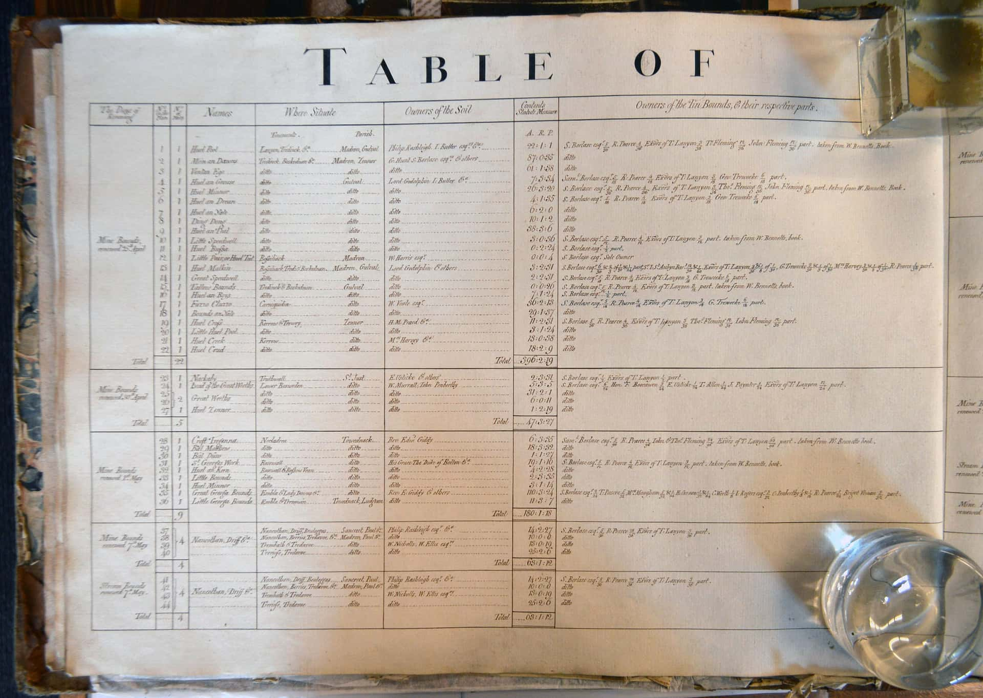
A plan found by a mate of mine purports to be "Tin Bounds and Lands Belonging to Lord de Dunstanville in the parish of Wendron". It is undated but stylistically similar to the Doige estate surveys. Strangely, it features a much more refined presentation of schedule than his 1730s works.
Recorded are some 3 dozen bounds, bounded by Basset himself (without a middle man), as well as a representation of freeholds. The land map is clearly Doige, be it copied or produced in his style, but the bounds looks like they have been drawn of a more modern hand by probably a couple of decades.
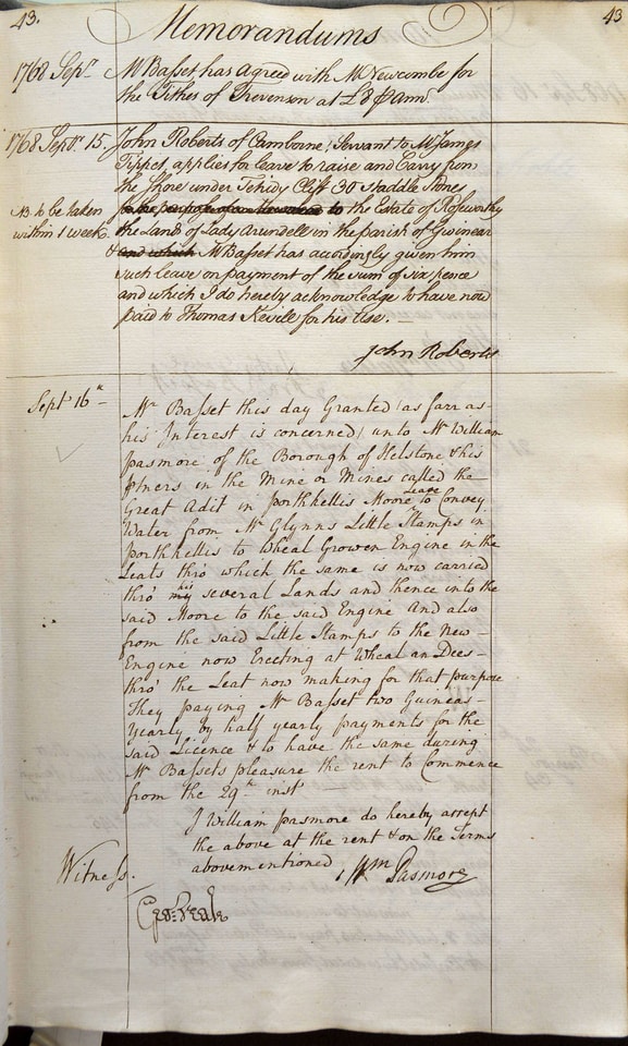
The Bassets exhibited the première example of mining enterprising from the early 18th century to the mid-20th century, when they the family name went extinct. Very little of their early records have survived, but a wealth of mining information can be found in their Stewards' Memorandum books and other miscellaneous accessions to the archives. Whilst reading through a one such mid-18th century example for the estate, I found this reference dated Jun 27 1766:
"Martin Pascoe says that a small pain of Tin Bounds called Pool Bounds in the map of Tin Bounds in Wendron, have not been renewed for upwards of 20yrs..." ('Pool bounds' was in the horse field next to Halwin lane, northeast of Porkellis)
If the implication is that by this time the map had been in existence for 20yrs then this might be the very earliest map of bounds to survive today. It is currently in a cardboard box, I am told.
From the 1760s onwards, many tin bounds maps appeared but the largest and most ambitious to have ever been made to-date were at the hand of Willaim Terril, surveyor of Redruth for the Enys estate. Two large plans exist, both 1778, one of bounds in St Agnes and another for Kenwyn (safe, but in a private archive). These remained unparalleled in size and ambition in the history of mapping tin bounds.
A more refined style was however cultivated by that of estate surveyor Charles Moody. One of his first works was in draughting Borlase's tin bounds which had been surveyed as acreages in the late 17th century. The folio of plans still survives and can be consulted in the RIC in Truro.
The refined style of Moody was perpetuated by Richard Thomas, a railway engineer of Falmouth who turned his hand to map making and excelled against all the competition in the process. He produced plans of tin bounds belonging to J W Barnicoat in St Agnes, Kenwyn and Perranzabuloe. For a time, these were on loan to the Cornish archives but have since been withdrawn and sold. Facsimile copies still exist, luckily.
Cornwall’s Copper Boom and the Decline of Tin Bounding
Bounding was never introduced for other metals, and as production grew to pivot around copper mining in the 19th century bound registrations were shown to be an archaic handbrake on the industry. The practice of setting - which could encompass any mineral - as a versatile means of arranging mining licence became the predominant means and could be done at a much lower level than Stannary Courts (which made them appeal to manorial Lords). That is not to say these Courts had entire lost their influence; they of course still had a tight control over registered costbook companies.
Not requiring the oversight of courts, merely the Lord or rights owner, setts were agreed between parties. As a legal proceeding, they were usually managed by local solicitors who retained the documents in case of dispute; many of these have been accessioned into the Cornish archives.
A quick search of the Stannary Court's collection in the archives suggests the last tin bounds were 'proclaimed' in 1870. Soon to follow would be the death blow: the "Stannaries Court (Abolition) Act 1896" ended a practice a little over 700yrs old. The "jurisdiction and powers of the said court and its officers..." were to "...be transferred to and vested in such of the county courts"; however, there is no evidence that such duty of bound registration was still enacted.
Interestingly, setting continued. Following cases like Eardley v Granville (1876) which tested the subsurface underground to be real estate in fee simple, mineral rights were easier to tax and so I assume - in lieu of a proper legal analysis - that bounding an area prior to setting was deemed non-essential on taxation grounds. Further study into 20th century setts may yet yield better insights from this period. Certainly, much of the China Clay Industry was carried out under mining sett agreements, the last being seen in the 1960s.
It is difficult to hypothesise why or even if the practice has stopped. It is true that the format of a sett is quite wordy and inflexible; and maybe a generic licence might be the preferred choice today. Setting was a zero-liability game which is hardly any more the flavour of the month.
But what of tin bounding, though? The obvious answer is that no stannary courts = no bounding. De facto, this is obviously the case, however, powers of the courts were still conveyed to county courts de-jure. I'm no lawyer, but reading through the 1896 act, it appears that it is still being continually being amended and appended. Section 1A was inserted in 2014 and 3 in 2006: the latter is of interest because it states that the "Lord Chief Justice may nominate a judicial office holder to exercise his functions under this section". De-facto vice warden maybe?
There does not appear to be any legislation abolishing the stannary districts themselves - if they are anything at all without their administration. The fact that bounding was built on manorial foundations however leaves the potential of re-enacting their tenure to be murky at best. I understand that bounding was typically done on manorial demesne, and rarely freeholds (if ever, I have not found any evidence of this).
It did occur on copyholdings, however this held a much stronger tie with the manorial and a has great legal precedent of mining. The Duchy of Cornwall Acts 1844, prompted mapping of all assession manors; they made a feature of distinguishing between conventionary, demesne and freehold lands for this reason.
The Law Property Act 1925 nullified the utility of manorial court by abolishing copyholding. All tenements held in this manner were enfranchised, the new freeholder holding "possession" of the minerals, and the manorial lord the "property". This was a mutual veto whereby if mining were to start, both parties would need to form an agreement; the freeholder facilitating the mining in physical space and the Lord levying rights against the minerals returned. In reality, many enfranchisements were under reservation of mineral fee, hence the Lord retained all rights as you would expect with surface real estate.
Land in freehold is not necessarily without a Lord and associated manorial rights. These are termed overriding interests and had to be conveyanced explicitly if they are to apply to the freehold; if your title deeds are silent on things like game right, amenity, market and such like it means these remained the interests of the Lord of the manor; even after his demesne was enfranchised. The Land Registry Act 2002 - with aim to create a GIS cadastre, whereby all interests in a given parcel of land can be viewed in its title - gave a 10 year curfew after which overriding interests would lose automatic protection during conveyance.
The other part of the act repeals any further registry of manors as separate tenure to freeholds. Manorial Lordship is still registrable, however under the LPA 1925 this is independent to practical application of incident through overriding interest. The core maxim of feudalism: "Nulle terre sans seigneur" ("No land without a lord") is rendered effectively null and void if you now buy land which isn't cautioned or has interests reserved.
Considering bounding was the practice of the Lord of the Soil having manorial domain registered in which mining was permitted without manorial condition, which as custom of the stannary courts was considered conveyable chattels real; it would stand that land held under manorial title (e.g. registered as fee simple to a holder of manorial Lordship) after 12 October 2013 with mineral interests could satisfy the requirements to be bounded if stannary powers were to be re-invoked.
You would not, however - through my line of reasoning - be able to bound freehold land without manorial interest (e.g. land conveyed after 12 Oct 2013 without a notice or caution), not that this was the done thing even when bounding was still practised.
Conclusion
In summary: there is nothing I can see to stop you from walking into the solicitors and creating a mining sett, given you have bought your property in fee simple after 12 Oct 2013 void of caution. You could not, however, bound it. As a manorial Lord who has protected their interests, you might still be able to, given the County Courts agreed to invoke this custom of the stannary courts. If you were to declare your land bounded without proclamation in stannary, or now county court, you would be implicitly creating an obfuscated sett.


